Hurricane Rachel Expected to Impact Southern California This Weekend
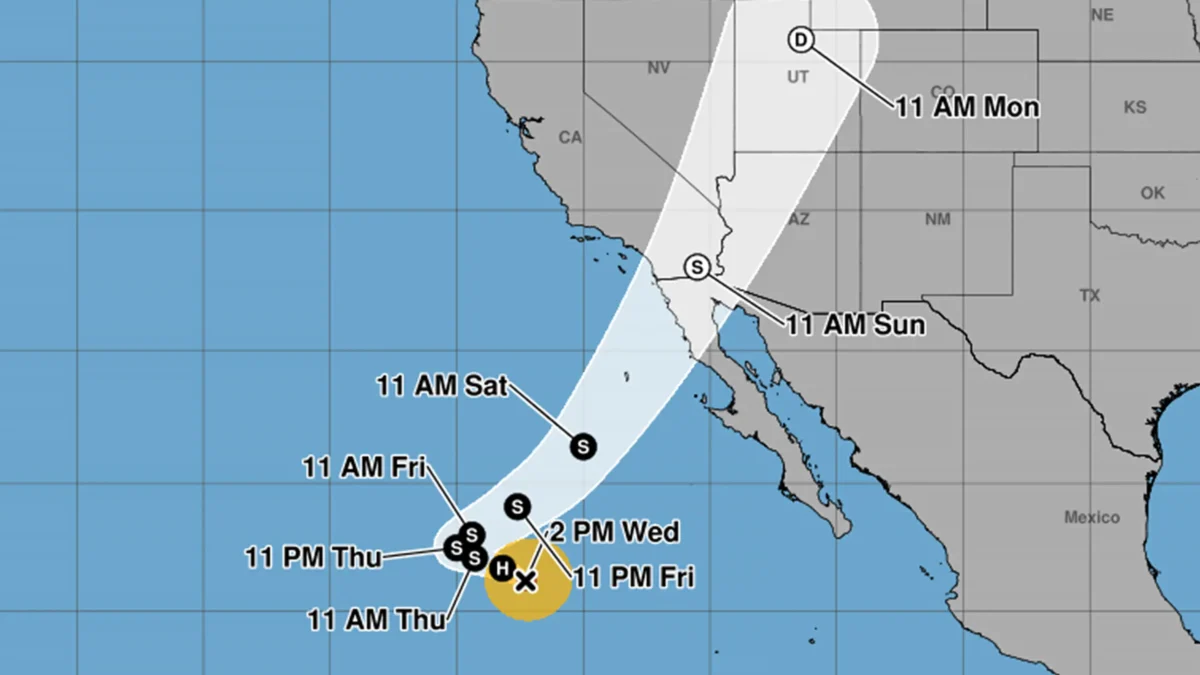
Southern California residents should prepare for adverse weather conditions this weekend as Hurricane Rachel approaches the region. The storm is predicted to turn northeast and move toward Northern Baja California and the Southern California coast.
Although Rachel is expected to weaken into a tropical storm within the next 24 hours, it may still reach land as a post-tropical cyclone with winds up to 45 miles per hour. Rainfall is anticipated across Southern California, and wind could create storm surges that may flood low-lying areas.
The exact landfall location remains uncertain, with predictions ranging from Orange County to Punta Colonet, and some forecasts suggesting a landing south of Ensenada, Mexico. Climate scientist Daniel Swain noted that potential outcomes vary significantly, indicating a possibility of either dry conditions or a rare October rain and windstorm for areas like San Diego. Additionally, models indicate a strong low-pressure system could develop near San Diego, potentially leading to heavy rainfall and significant coastal flooding.
Surf conditions will be influenced by the storm's behavior, with swells generated by Rachel expected to create life-threatening surf and rip currents along the Southern California coast. As the storm approaches, forecasts will continue to be updated to provide clarity on its path and impacts.
